Detect registry conflicts
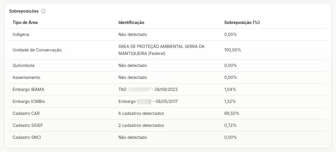
Cross the analyzed area with datasets such as SICAR, SIGEF, and SNCI to identify potential inconsistencies, duplicates, or boundary conflicts.
%20Text:%20soli%20(all%20lowercase)%20Font%20size:%2080px,%20letter-spacing:%20-2px%20Generated%20with%20opentype.js%20from%20Google%20Fonts%20TTF%20Variants:%20soli-logo-white.svg%20(fill%20%23FFFFFF)%20--%3e%3csvg%20xmlns='http://www.w3.org/2000/svg'%20viewBox='0%200%20127%2068'%20width='127'%20height='68'%3e%3cpath%20d='M22.92%2063.96L22.92%2063.96Q15.04%2063.96%2010.08%2060.48Q5.12%2057.00%204%2050.68L4%2050.68L12.56%2049.36Q13.36%2052.72%2016.26%2054.66Q19.16%2056.60%2023.48%2056.60L23.48%2056.60Q27.40%2056.60%2029.62%2055.00Q31.84%2053.40%2031.84%2050.60L31.84%2050.60Q31.84%2048.96%2031.06%2047.94Q30.28%2046.92%2027.80%2046Q25.32%2045.08%2020.24%2043.72L20.24%2043.72Q14.68%2042.28%2011.42%2040.62Q8.16%2038.96%206.78%2036.74Q5.40%2034.52%205.40%2031.36L5.40%2031.36Q5.40%2027.44%207.48%2024.52Q9.56%2021.60%2013.34%2020Q17.12%2018.40%2022.20%2018.40L22.20%2018.40Q27.16%2018.40%2031.04%2019.96Q34.92%2021.52%2037.32%2024.38Q39.72%2027.24%2040.20%2031.08L40.20%2031.08L31.64%2032.64Q31.20%2029.52%2028.72%2027.72Q26.24%2025.92%2022.28%2025.76L22.28%2025.76Q18.48%2025.60%2016.12%2027.02Q13.76%2028.44%2013.76%2030.92L13.76%2030.92Q13.76%2032.36%2014.66%2033.36Q15.56%2034.36%2018.16%2035.28Q20.76%2036.20%2025.84%2037.48L25.84%2037.48Q31.28%2038.88%2034.48%2040.58Q37.68%2042.28%2039.06%2044.62Q40.44%2046.96%2040.44%2050.28L40.44%2050.28Q40.44%2056.68%2035.78%2060.32Q31.12%2063.96%2022.92%2063.96ZM66.04%2064L66.04%2064Q59.56%2064%2054.80%2061.08Q50.04%2058.16%2047.46%2053.02Q44.88%2047.88%2044.88%2041.16L44.88%2041.16Q44.88%2034.40%2047.52%2029.26Q50.16%2024.12%2054.92%2021.26Q59.68%2018.40%2066.04%2018.40L66.04%2018.40Q72.52%2018.40%2077.28%2021.32Q82.04%2024.24%2084.64%2029.36Q87.24%2034.48%2087.24%2041.16L87.24%2041.16Q87.24%2047.92%2084.62%2053.06Q82%2058.20%2077.24%2061.10Q72.48%2064%2066.04%2064ZM66.04%2056.12L66.04%2056.12Q72.24%2056.12%2075.30%2051.94Q78.36%2047.76%2078.36%2041.16L78.36%2041.16Q78.36%2034.40%2075.26%2030.34Q72.16%2026.28%2066.04%2026.28L66.04%2026.28Q61.84%2026.28%2059.12%2028.18Q56.40%2030.08%2055.08%2033.42Q53.76%2036.76%2053.76%2041.16L53.76%2041.16Q53.76%2047.96%2056.88%2052.04Q60%2056.12%2066.04%2056.12ZM103.20%2062.80L94.84%2062.80L94.84%204L103.20%204L103.20%2062.80ZM122.36%2012.52L114%2012.52L114%204.40L122.36%204.40L122.36%2012.52ZM122.36%2062.80L114%2062.80L114%2019.60L122.36%2019.60L122.36%2062.80Z'%20fill='%230B3D3B'/%3e%3c/svg%3e)
Overlap Analysis
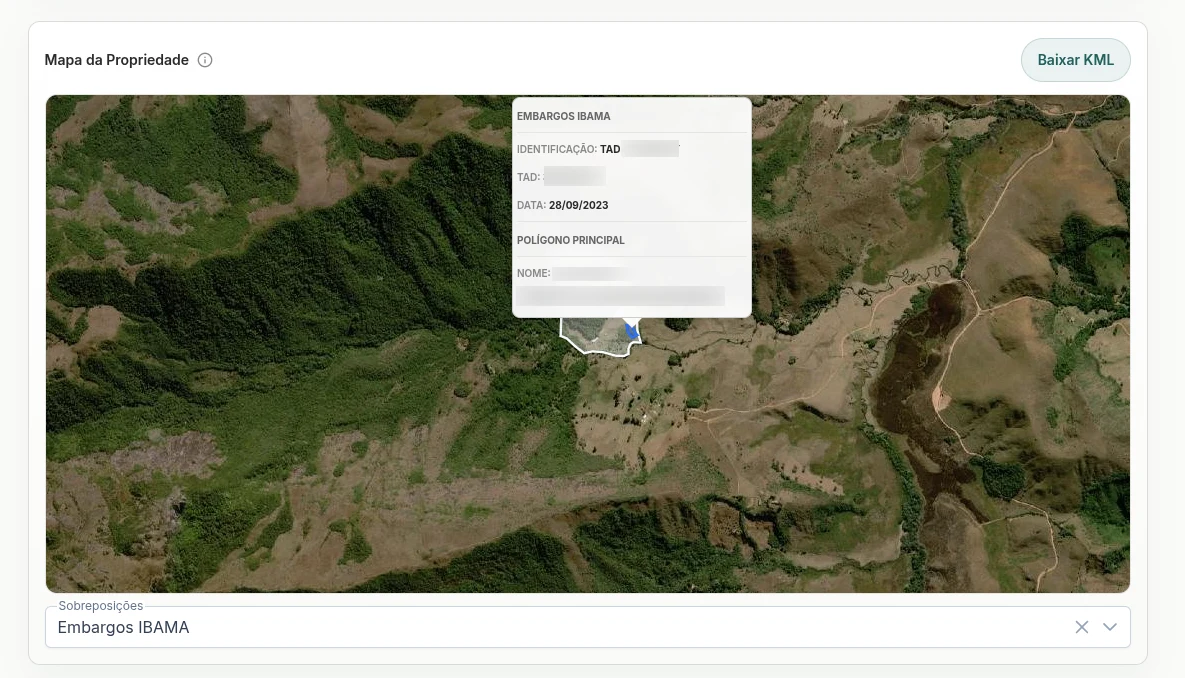
Identify land, environmental, and territorial overlaps in a few clicks. Soli crosses critical layers so your team can assess risk before moving forward with an operation.
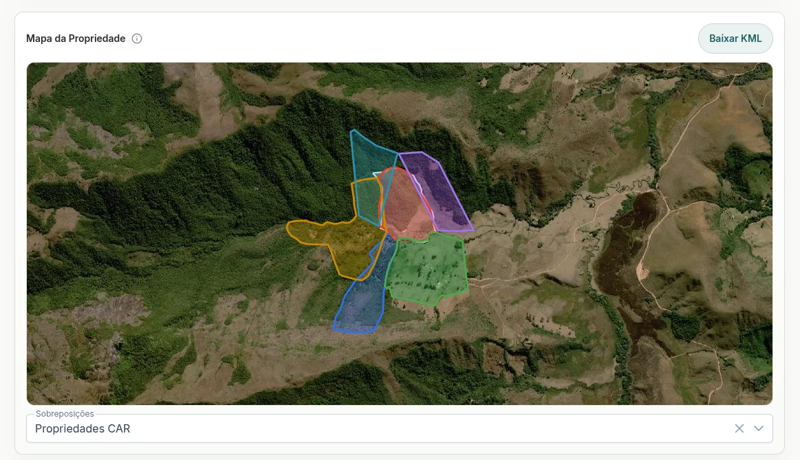
Cross the analyzed area with datasets such as SICAR, SIGEF, and SNCI to identify potential inconsistencies, duplicates, or boundary conflicts.
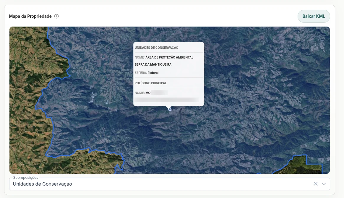
Check intersections with Conservation Units, Indigenous Lands, Quilombola territories, and other sensitive areas.
Reduce manual checks across multiple sources. Centralize spatial analysis in one platform to prioritize lower-risk areas.
Use overlap analysis as a starting point for acquisition, rural credit, compliance, due diligence, origination, or portfolio management.
Benefits
Built for
Assess collateral, rural credit, and social-environmental risk before operating.
Analyze suppliers, expansion areas, leases, or origination with less uncertainty.
Search for land opportunities with greater predictability and lower hidden risk.
Deliver territorial diagnostics quickly to support negotiation and decisions.
Evaluate land and environmental risks for internal processes and audits.
Understand rural property risks with integrated territorial data in a single platform.