%20Text:%20soli%20(all%20lowercase)%20Font%20size:%2080px,%20letter-spacing:%20-2px%20Generated%20with%20opentype.js%20from%20Google%20Fonts%20TTF%20Variants:%20soli-logo-white.svg%20(fill%20%23FFFFFF)%20--%3e%3csvg%20xmlns='http://www.w3.org/2000/svg'%20viewBox='0%200%20127%2068'%20width='127'%20height='68'%3e%3cpath%20d='M22.92%2063.96L22.92%2063.96Q15.04%2063.96%2010.08%2060.48Q5.12%2057.00%204%2050.68L4%2050.68L12.56%2049.36Q13.36%2052.72%2016.26%2054.66Q19.16%2056.60%2023.48%2056.60L23.48%2056.60Q27.40%2056.60%2029.62%2055.00Q31.84%2053.40%2031.84%2050.60L31.84%2050.60Q31.84%2048.96%2031.06%2047.94Q30.28%2046.92%2027.80%2046Q25.32%2045.08%2020.24%2043.72L20.24%2043.72Q14.68%2042.28%2011.42%2040.62Q8.16%2038.96%206.78%2036.74Q5.40%2034.52%205.40%2031.36L5.40%2031.36Q5.40%2027.44%207.48%2024.52Q9.56%2021.60%2013.34%2020Q17.12%2018.40%2022.20%2018.40L22.20%2018.40Q27.16%2018.40%2031.04%2019.96Q34.92%2021.52%2037.32%2024.38Q39.72%2027.24%2040.20%2031.08L40.20%2031.08L31.64%2032.64Q31.20%2029.52%2028.72%2027.72Q26.24%2025.92%2022.28%2025.76L22.28%2025.76Q18.48%2025.60%2016.12%2027.02Q13.76%2028.44%2013.76%2030.92L13.76%2030.92Q13.76%2032.36%2014.66%2033.36Q15.56%2034.36%2018.16%2035.28Q20.76%2036.20%2025.84%2037.48L25.84%2037.48Q31.28%2038.88%2034.48%2040.58Q37.68%2042.28%2039.06%2044.62Q40.44%2046.96%2040.44%2050.28L40.44%2050.28Q40.44%2056.68%2035.78%2060.32Q31.12%2063.96%2022.92%2063.96ZM66.04%2064L66.04%2064Q59.56%2064%2054.80%2061.08Q50.04%2058.16%2047.46%2053.02Q44.88%2047.88%2044.88%2041.16L44.88%2041.16Q44.88%2034.40%2047.52%2029.26Q50.16%2024.12%2054.92%2021.26Q59.68%2018.40%2066.04%2018.40L66.04%2018.40Q72.52%2018.40%2077.28%2021.32Q82.04%2024.24%2084.64%2029.36Q87.24%2034.48%2087.24%2041.16L87.24%2041.16Q87.24%2047.92%2084.62%2053.06Q82%2058.20%2077.24%2061.10Q72.48%2064%2066.04%2064ZM66.04%2056.12L66.04%2056.12Q72.24%2056.12%2075.30%2051.94Q78.36%2047.76%2078.36%2041.16L78.36%2041.16Q78.36%2034.40%2075.26%2030.34Q72.16%2026.28%2066.04%2026.28L66.04%2026.28Q61.84%2026.28%2059.12%2028.18Q56.40%2030.08%2055.08%2033.42Q53.76%2036.76%2053.76%2041.16L53.76%2041.16Q53.76%2047.96%2056.88%2052.04Q60%2056.12%2066.04%2056.12ZM103.20%2062.80L94.84%2062.80L94.84%204L103.20%204L103.20%2062.80ZM122.36%2012.52L114%2012.52L114%204.40L122.36%204.40L122.36%2012.52ZM122.36%2062.80L114%2062.80L114%2019.60L122.36%2019.60L122.36%2062.80Z'%20fill='%230B3D3B'/%3e%3c/svg%3e)
Corporate solutions for agribusiness
Data, AI, and georeferencing for companies making decisions at scale
Soli combines geospatial intelligence, applied AI, satellite monitoring, computer vision, and data science to create corporate solutions for agribusiness. We turn complex datasets into products, analyses, and workflows that help enterprise teams act with greater speed and confidence.
Open to new challenges
You bring the problem. We design the data solution.
Applied AI for rural business
Models, automations, and tailored analyses to turn territorial, operational, and commercial data into decisions.
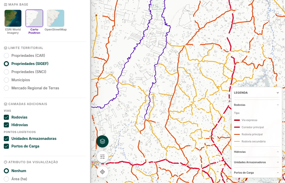
Georeferencing and territorial intelligence
Integrate properties, polygons, public datasets, and private layers to see risk, potential, and priority at scale.
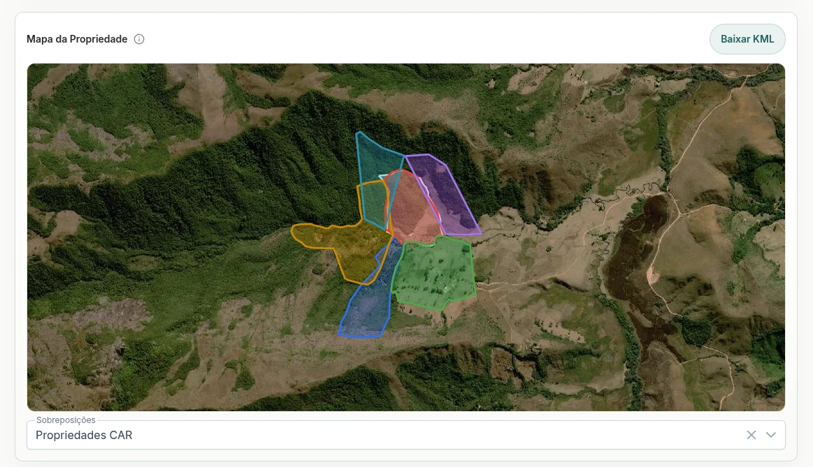
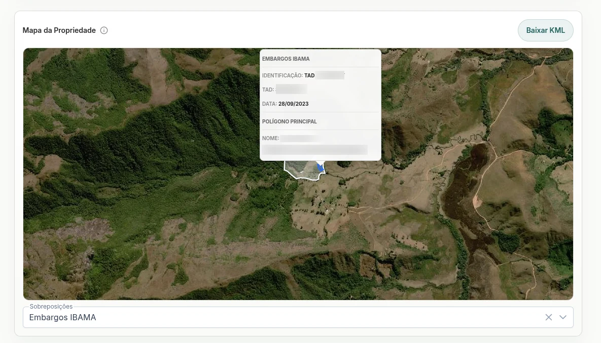
Satellite monitoring
Track changes in territory, vegetation, environmental alerts, and production indicators with historical series and visual evidence.
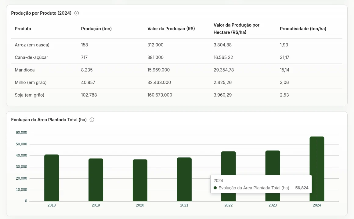
Computer vision and data science
Extract signals from images, documents, maps, and geospatial datasets with analytical pipelines built for your operation.
Why Soli
Experts who build solutions beyond off-the-shelf products
- Tailored projects for companies, financial institutions, and agribusiness operations
- Specialists in geospatial data, applied AI, monitoring, and rural analysis
- Integration of public, private, satellite, and operational data
- Rapid proofs of concept to validate value before scaling
- Dashboards, reports, and APIs aligned with your team workflow
- Consultative perspective to discover solutions beyond the initial scope
Possibilities
Projects for teams moving from raw data to action
Territorial risk and compliance
Monitor suppliers, collateral, production areas, and rural assets with environmental, land, and regulatory evidence.
Origination and expansion
Prioritize regions, producers, properties, and opportunities with models combining market, logistics, productivity, and risk.
Operational monitoring
Track field changes, alerts, vegetation indices, and relevant events for property or supplier portfolios.
Digital products for agribusiness
Create modules, APIs, automated reports, and analytical experiences for internal teams, partners, or end users.
Built for
Companies that need deep agribusiness intelligence
Agribusiness companies
Origination, expansion, procurement, sustainability, and intelligence teams.
Banks and insurers
Credit analysis, collateral, social-environmental risk, monitoring, and audit.
Traders and industries
Supplier control, origin areas, logistics, and territorial exposure.
Funds and investors
Due diligence, valuation, acquisition theses, and rural portfolio management.
Talk to Soli
Tell us about your company challenge
Share a brief context and our team will understand the scenario, suggest paths, and assess how AI, geospatial data, satellite monitoring, and data science can create impact for your case.