Map access and strategic routes
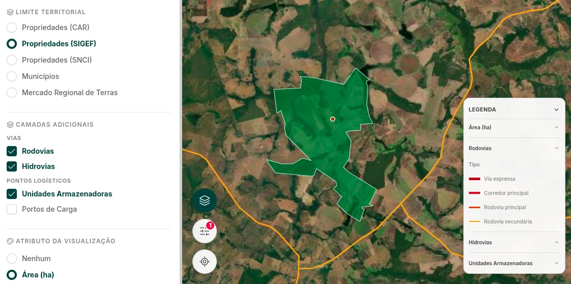
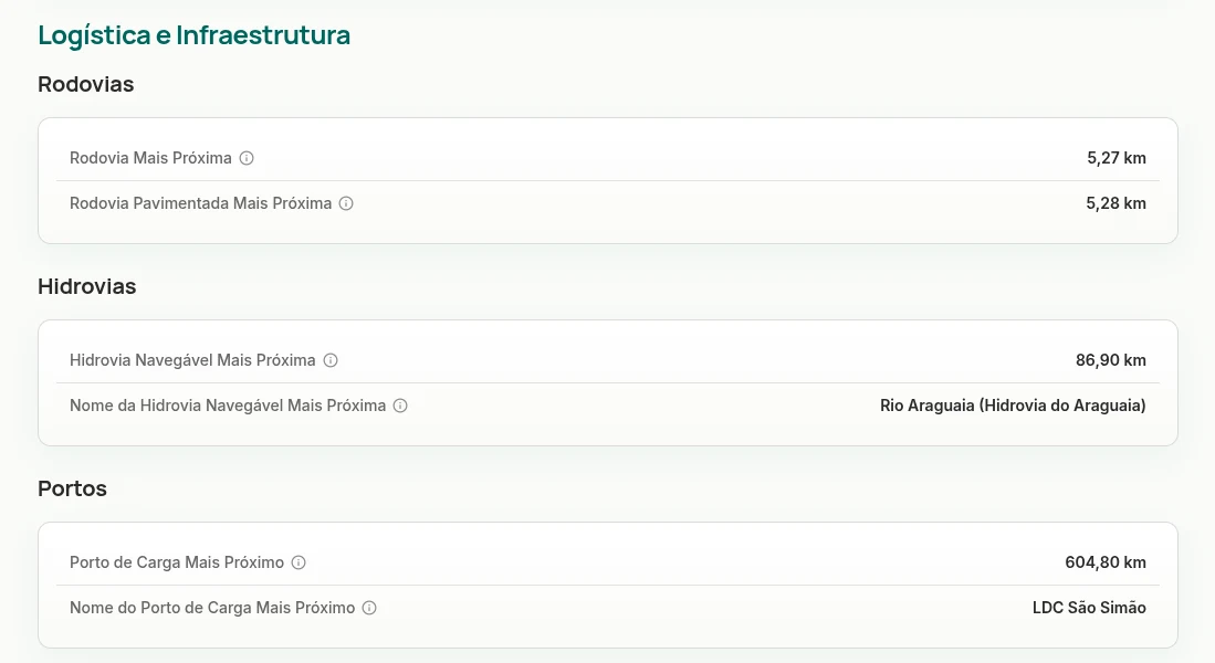
View how a property relates to roads, railways, waterways, ports, airports, and consumer centers to understand its logistics position.
%20Text:%20soli%20(all%20lowercase)%20Font%20size:%2080px,%20letter-spacing:%20-2px%20Generated%20with%20opentype.js%20from%20Google%20Fonts%20TTF%20Variants:%20soli-logo-white.svg%20(fill%20%23FFFFFF)%20--%3e%3csvg%20xmlns='http://www.w3.org/2000/svg'%20viewBox='0%200%20127%2068'%20width='127'%20height='68'%3e%3cpath%20d='M22.92%2063.96L22.92%2063.96Q15.04%2063.96%2010.08%2060.48Q5.12%2057.00%204%2050.68L4%2050.68L12.56%2049.36Q13.36%2052.72%2016.26%2054.66Q19.16%2056.60%2023.48%2056.60L23.48%2056.60Q27.40%2056.60%2029.62%2055.00Q31.84%2053.40%2031.84%2050.60L31.84%2050.60Q31.84%2048.96%2031.06%2047.94Q30.28%2046.92%2027.80%2046Q25.32%2045.08%2020.24%2043.72L20.24%2043.72Q14.68%2042.28%2011.42%2040.62Q8.16%2038.96%206.78%2036.74Q5.40%2034.52%205.40%2031.36L5.40%2031.36Q5.40%2027.44%207.48%2024.52Q9.56%2021.60%2013.34%2020Q17.12%2018.40%2022.20%2018.40L22.20%2018.40Q27.16%2018.40%2031.04%2019.96Q34.92%2021.52%2037.32%2024.38Q39.72%2027.24%2040.20%2031.08L40.20%2031.08L31.64%2032.64Q31.20%2029.52%2028.72%2027.72Q26.24%2025.92%2022.28%2025.76L22.28%2025.76Q18.48%2025.60%2016.12%2027.02Q13.76%2028.44%2013.76%2030.92L13.76%2030.92Q13.76%2032.36%2014.66%2033.36Q15.56%2034.36%2018.16%2035.28Q20.76%2036.20%2025.84%2037.48L25.84%2037.48Q31.28%2038.88%2034.48%2040.58Q37.68%2042.28%2039.06%2044.62Q40.44%2046.96%2040.44%2050.28L40.44%2050.28Q40.44%2056.68%2035.78%2060.32Q31.12%2063.96%2022.92%2063.96ZM66.04%2064L66.04%2064Q59.56%2064%2054.80%2061.08Q50.04%2058.16%2047.46%2053.02Q44.88%2047.88%2044.88%2041.16L44.88%2041.16Q44.88%2034.40%2047.52%2029.26Q50.16%2024.12%2054.92%2021.26Q59.68%2018.40%2066.04%2018.40L66.04%2018.40Q72.52%2018.40%2077.28%2021.32Q82.04%2024.24%2084.64%2029.36Q87.24%2034.48%2087.24%2041.16L87.24%2041.16Q87.24%2047.92%2084.62%2053.06Q82%2058.20%2077.24%2061.10Q72.48%2064%2066.04%2064ZM66.04%2056.12L66.04%2056.12Q72.24%2056.12%2075.30%2051.94Q78.36%2047.76%2078.36%2041.16L78.36%2041.16Q78.36%2034.40%2075.26%2030.34Q72.16%2026.28%2066.04%2026.28L66.04%2026.28Q61.84%2026.28%2059.12%2028.18Q56.40%2030.08%2055.08%2033.42Q53.76%2036.76%2053.76%2041.16L53.76%2041.16Q53.76%2047.96%2056.88%2052.04Q60%2056.12%2066.04%2056.12ZM103.20%2062.80L94.84%2062.80L94.84%204L103.20%204L103.20%2062.80ZM122.36%2012.52L114%2012.52L114%204.40L122.36%204.40L122.36%2012.52ZM122.36%2062.80L114%2062.80L114%2019.60L122.36%2019.60L122.36%2062.80Z'%20fill='%230B3D3B'/%3e%3c/svg%3e)
Logistics and Infrastructure Analysis
Understand how far a property is from roads, railways, ports, warehouses, silos, plants, and other strategic points. Soli helps your team compare areas and identify opportunities with better infrastructure access.
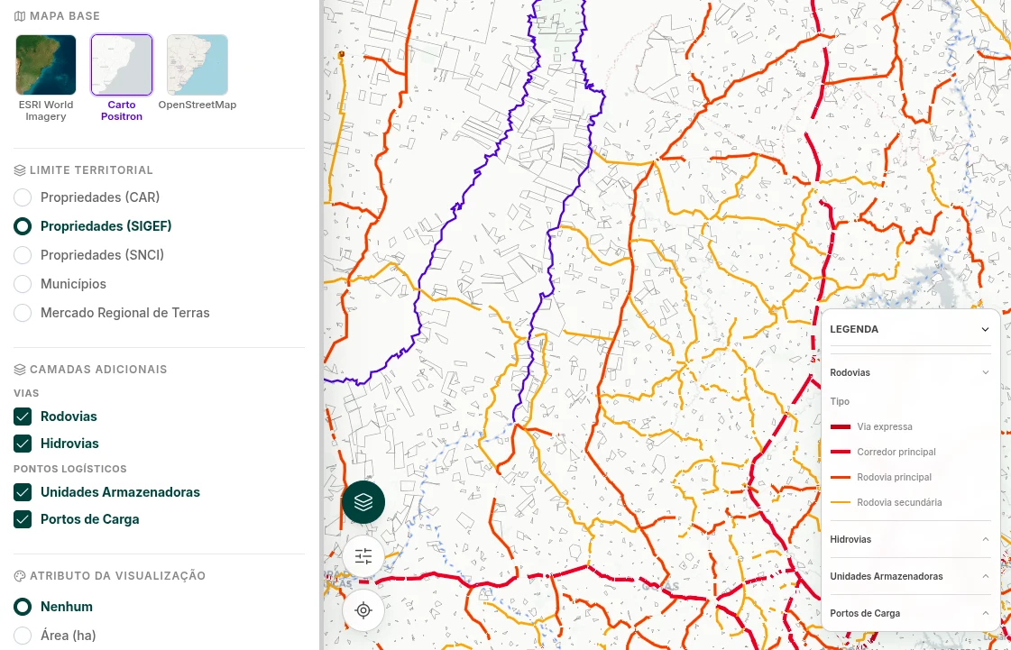
View how a property relates to roads, railways, waterways, ports, airports, and consumer centers to understand its logistics position.
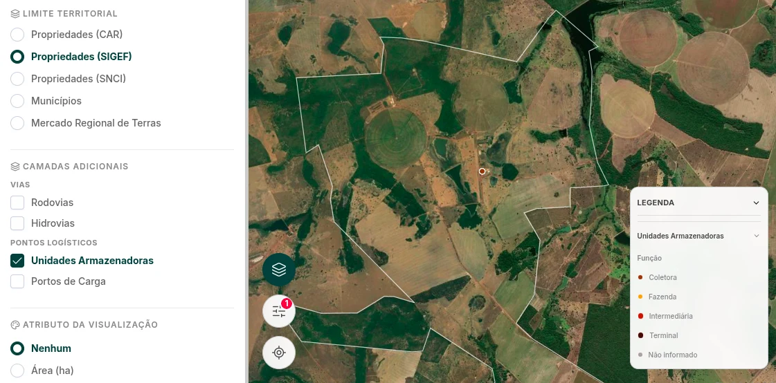
Analyze proximity to silos, warehouses, plants, traders, cooperatives, slaughterhouses, and processing units relevant to the operation.
Prioritize areas with better connectivity, shorter distance to strategic points, and greater potential for transport, acquisition, or development.
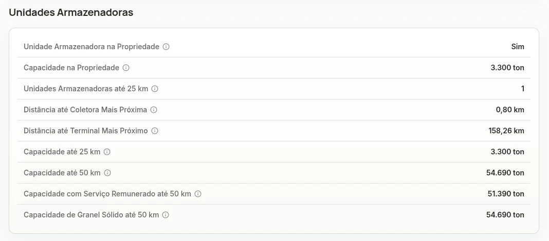
Use logistics data to support land acquisition, agricultural origination, operational feasibility, rural valuation, and portfolio management.
Benefits
Built for
Evaluates production, origination, leasing, or expansion areas with a focus on connectivity and operations.
Analyze rural collateral, operational risk, and property economic potential before approving credit.
Seek land with better logistics positioning and nearby infrastructure for acquisition and appreciation.
Map access to suppliers, production hubs, and storage structures to support the chain.
Prepare feasibility, valuation, and territorial prospecting studies based on logistics data.
Use Soli to evaluate infrastructure, access, and strategic points around rural areas.